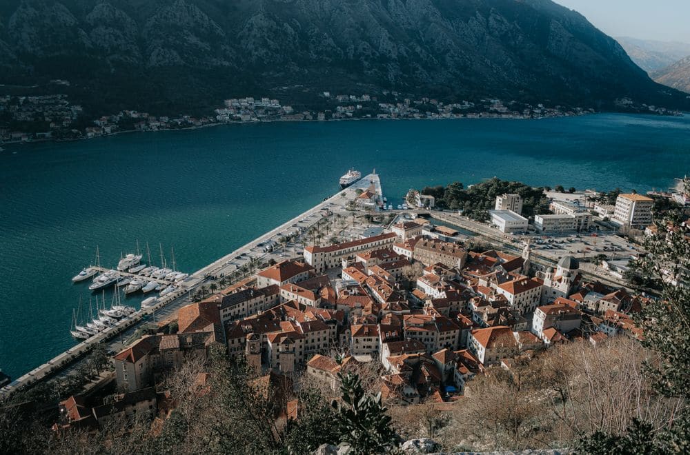
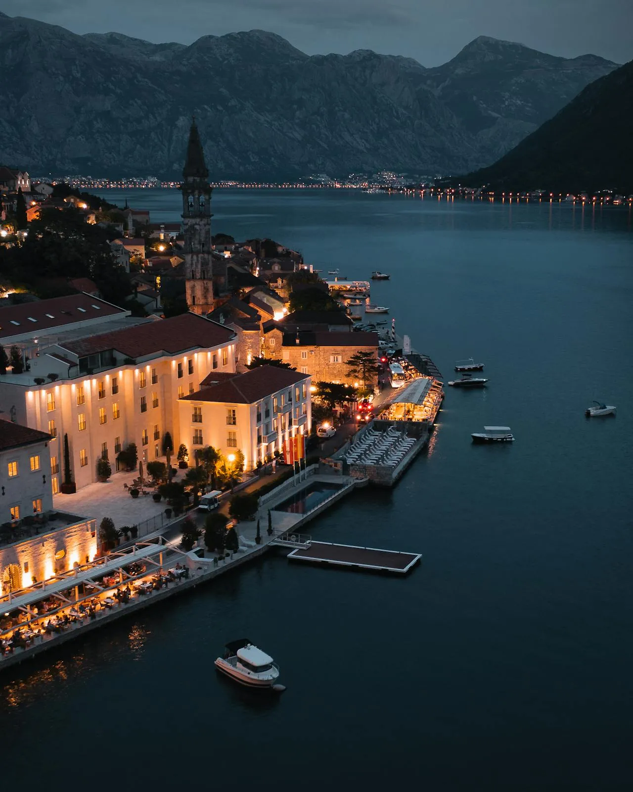
A village you drive to, then walk into
Gornji Stoliv, literally "Upper Stoliv", is not a place you can drive to. The stone lanes that climb to it are old mule paths, too narrow and too steep for anything on four wheels. The village sits at roughly 240 metres on the western flank of Mount Vrmac, above the hamlet of Donji Stoliv on the bay shore, and the only way in is on foot. What looks on the map like a ten-minute detour is a forty-minute climb through chestnut forest.
That inconvenience is the whole reason to go. The families who lived here for five centuries built the village deliberately out of reach, first of pirates working the coast, later of malaria in the marshes. When the threats eased and the next generation chose boats over olive presses, they walked down the hill for good. What they left is now one of the most atmospheric ruin walks in the Boka.
A note on driving up: locals and service vehicles occasionally take a high-clearance 4x4 up the stone track, and travellers sometimes ask whether a jeep rental can manage it. In practice the track is single-lane, unsurfaced, has almost no turning space once you commit, and a meeting with an oncoming vehicle turns into a long reverse. We don’t recommend it for tourist drivers, the drive-and-walk plan below is how every hiking guide, boat-captain local, and village resident will tell you to do it.
Where to drive and where to park
From Kotor Old Town, follow the coast road west through Muo and Prčanj. Donji Stoliv sits about 9 km along the shore, roughly 20-25 minutes by car depending on summer traffic. A rental car is what gets you to the trailhead here; you drive the bay to lower Stoliv and walk up from there, since the upper village itself is mule-path only. The village is strung out along a single seaside road; keep going until you reach the Church of St Elias (Sveti Ilija) by the waterfront, the white stone church with the bell tower that every local uses as the meeting point.
Roadside parking is informal but usually available outside peak August weekends. Pull onto the widened verge near the church, not in front of residents’ gates; a compact rental car tucks into the verge spots far more easily than an SUV. There is no parking charge. If the verge by St Elias is full, the small post office (Pošta) a couple of hundred metres further west is the backup, both are marked on maps as the standard trailheads for Gornji Stoliv.
The footpath up
From the church, cross the coast road and look for the signposted lane marked with a red-and-white hiking blaze. The path is stepped stone for most of the climb, an old donkey track that rises through terraced garden plots, then plunges into the dense chestnut forest that gives the walk its character. It is graded, marked, and technically easy, but relentlessly uphill. Allow 40 minutes up at an unhurried pace, 25-30 down.
There is no water on the trail. Montenegro summers here get properly hot; bring a litre per person and plan the walk for before 10am or after 4pm if you are hiking in July or August. Sturdy trainers are enough, this is not a mountain scramble, but flip-flops will have you regretting life within the first switchback.
Live Kotor car rental prices for your exact dates.
Free cancellation available on most cars
What you’ll find at the top
Gornji Stoliv was founded in the 14th century by seafaring families whose husbands worked the Adriatic galleys while the women and older generations farmed the terraces, pressed olives, and raised goats. At its peak the village had roughly a hundred houses, several bakeries, a grocery, olive mills, and, the reason the community cohered, a parish church.
Today most of the houses are roofless shells, their lintels still carved with the century-crossed date stones. The Baroque Church of St Anne (Sveta Ana) is the exception. Still consecrated, still intermittently maintained, it sits on a flagged terrace with what may be the single best view over Perast in the whole Boka, the two islands (Our Lady of the Rocks, St George) float in the middle distance and the mountain horseshoe of the bay rises behind them.
Walk the lanes slowly. You will find the carved stone trough where the women did laundry, the remains of a communal oven, and, near the church, a small cluster of gravestones that read like a timeline of when the village finally gave up.
Continuing the loop to Prčanj
If you have a full morning and are in reasonable hiking shape, don’t turn around at the village. The path continues upward another 90 minutes or so to the Kalvarija saddle at around 540 m, then drops through pine and more chestnut down the eastern flank to Prčanj, the coastal village one bay-inlet back toward Kotor. The full Stoliv-Kalvarija-Prčanj loop is 3.5-4 hours end to end.
The catch: you finish at Prčanj, not back at your car. The easy fix is to pre-arrange a taxi at Prčanj (about €10) or walk the flat 20 minutes back along the coast road to your parking spot at Donji Stoliv. For the coast-road logistics see our Dobrota waterfront walk, which links the same stretch of shore.
When to go
The chestnut canopy turns gold in October, and the trail that month is as close to a private experience as the Boka offers, you will have the ruins to yourselves. Spring (April-May) brings wildflowers across the old terraces. July and August are workable before 10am but genuinely uncomfortable by noon. Winter is fine for dry days but the stone steps can hold ice after a cold snap.
Pair with
If you’re making a day of the western bay shore, the islands of Our Lady of the Rocks visible from the Gornji Stoliv terrace are visitable by boat from Perast, a 15-minute drive further up the bay. The full Vrmac ridge trail also starts from the same general area for hikers wanting more elevation.
At a glance
A compact car suits the verge parking. Live prices for your dates.
Free cancellation available on most cars